 |
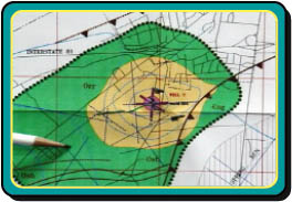
Delineation is the process used to identify and map the area around a pumping well that supplies water to the well or spring, or to identify and map the drainage basin that supplies water to a surface water intake. The size and shape of the area depends on the characteristics of the aquifer and the well, or the watershed. Within a SWP area, potential sources of contamination are inventoried and then managed to prevent pollution of the water used by the public water system (these topics are described in the next sections). The goal is to ensure that potential contaminant sources are managed in a manner that protects drinking water used by public water systems.
There are a couple of approaches that can be taken at the beginning of this step. First, you will decide who will do the scientific or rigorous delineation of the SWP area so that it meets the criteria established for the Pennsylvania Source Water Protection Program. You should select a qualified person familiar with hydrogeologic or hydrologic concepts. This person could be a consultant, or knowledgeable person(s) from the community who will volunteer their expertise. As rigorous delineations involve the "practice of geology", they must be performed by a Licensed Professional Geologist (P.G.). Alternatively, you may decide to wait until DEP provides a map that delineates the source of water to your public water system as required by the Safe Drinking Water Act. However, these delineations will be provided for source water assessment purposes only and a more rigorous delineation will be necessary for a local SWP program involving land-use controls such as ordinances. If you are to be supplied with the delineation by an outside source, such as DEP or a consultant, you can skip to the next step. If you are working on the delineation yourself or simply wish to become familiar with delineation methods, read on.
Delineation considers the characteristics of water flow in the aquifer or drainage basin and then narrows the focus to show areas where potential releases of certain contaminants would most probably end up in the community's water supply. Usually, the delineated source water protection area is further divided into regions called zones. Zones allow you to incorporate different management regimes based on separation distances between a potential contaminant source and the well or intake. Delineating zones allows a community to focus limited resources on the regions most critical to source water quality. Management of identified potential sources of contamination is discussed in the Step 4 (Management & Protection Strategies) Section. If land-use control will be part of your management program, a rigorous delineation is required to ensure that the controls will withstand legal challenges.
The "Case Studies" Section of this document provides detailed examples of delineation methods for the following systems:
- City of Allentown — Water Resources Bureau
- Reading Area Water Authority
- Telford Borough Authority
As part of the source water assessments required by the SDWA, DEP is currently in the process of providing SWP area delineations for all public water supplies. This project will require a few years to complete. Contact your Regional DEP SWAP Coordinator to find out when your source will be assessed.