Table 1 |
|
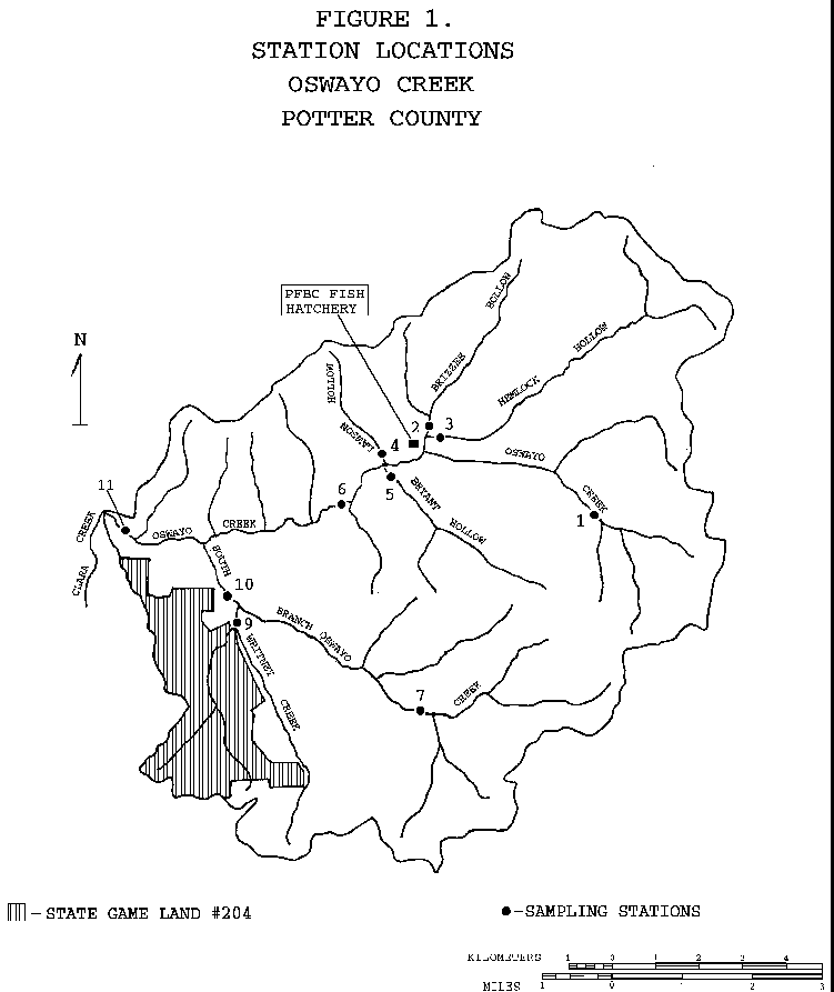
STATION |
LOCATION |
1OC |
Oswayo creek approximately 15 meters upstream of road T412 |
| Allegany Township | |
| Lat: 41 54 34 Long: 77 57 26 RMI: 30.0 | |
2BH |
Brizzee Hollow Run approximately 0.2 miles upstream of Hemlock Hollow Run |
| Oswayo Township | |
| Lat: 41 55 45 Long: 78 00 17 RMI: 0.4 | |
3HH |
Hemlock Hollow Run approximately 20 meters upstream of State Road (SR) 4025 |
| Oswayo Township | |
| Lat: 41 55 37 Long: 78 00 15 RMI: 0.1 | |
4LH |
Lawson Hollow approximately 10 meters upstream of Route 244 |
| Oswayo Township | |
| Lat: 41 55 19 Long: 78 01 03 RMI: 0.09 | |
5BH |
Bryant Hollow approximately 0.05 miles upstream of the mouth |
| Oswayo Township | |
| Lat: 41 55 13 Long: 78 01 01 RMI: 0.05 | |
6OS |
Oswayo Creek approximately 25 meters upstream of road T354 |
| Hebron Township | |
| Lat: 41 54 35 Long: 78 01 44 RMI: 25.5 | |
11OC |
Oswayo Creek approximately 25 meters upstream of road T351 |
| Clara Township | |
| Lat: 41 54 33 Long: 78 05 35 RMI: 21.3 | |
R2 |
Nelson Branch Hammersley Fork (23718) approximately 0.03 miles upstream from the mouth. |
| Potter County, Eulalia Township | |
| Lat: 41 28 16 Long: 77 52 58 RMI: 0.03 | |
R3 |
Hammersley Fork (23715) approximately 0.82 miles upstream from the mouth |
| Clinton County, Leidy Township | |
| Lat: 41 27 23 Long: 77 52 30 RMI: 0.82 | |
Return to the Oswayo Creek Page