|
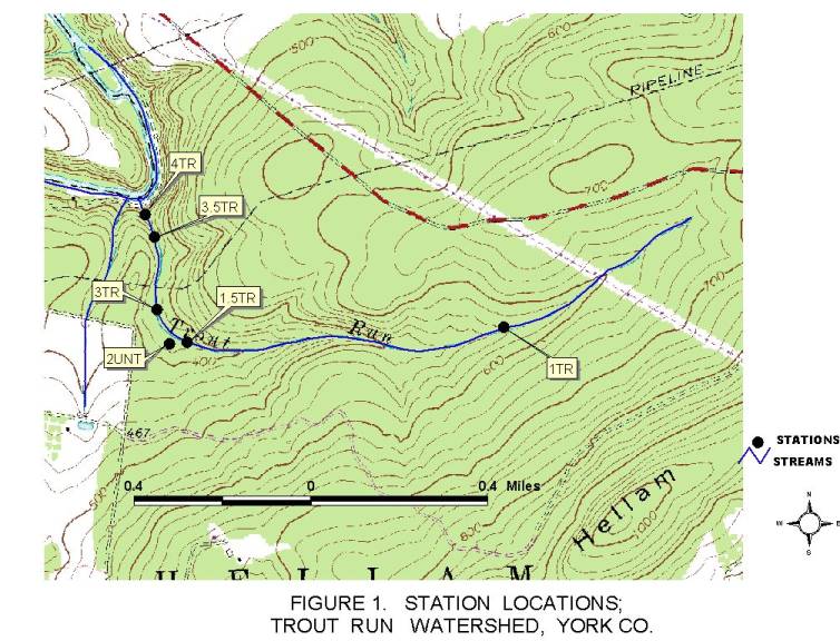
TABLE 1 |
||||
|
Station |
Stream |
River Mile Index |
Latitude/ Longitude |
Location |
|
1TR (1995) |
08035 |
1.1 |
40'02'20" 76'38'20" |
Approx. 400 yds. south of the powerline and Furnace Rd (SR66152) intersection. |
|
1.5TR (1998) |
08035 |
.3 |
40'02'17" 76’39'14" |
Approx. 20 yards upstream from mouth of 2UNT. |
|
2UNT (1995) |
none |
0.05 |
40'02'15" 76’39'16" |
Approx. 100 yds. upstream of Station 3, near the midpoint of Trout Run. |
|
3TR (1995) |
08035 |
0.25 |
40'02'20" 76'39'17" |
Approx. 200 yds. east of the intersection of T945 and T946. Near the Trout Run midpoint. |
|
3.5TR (1998) |
08035 |
.1
|
40'02'29" 76'39'18" |
Approx. 150 yds. upstream from mouth. |
|
4TR (1995) |
08035 |
.01 |
40’02'32” 76'39'20" |
30 yds. upstream from mouth. |
|
Note: See Figure 1 for Relative Station Locations. |
||||
Return to the Trout Run Page